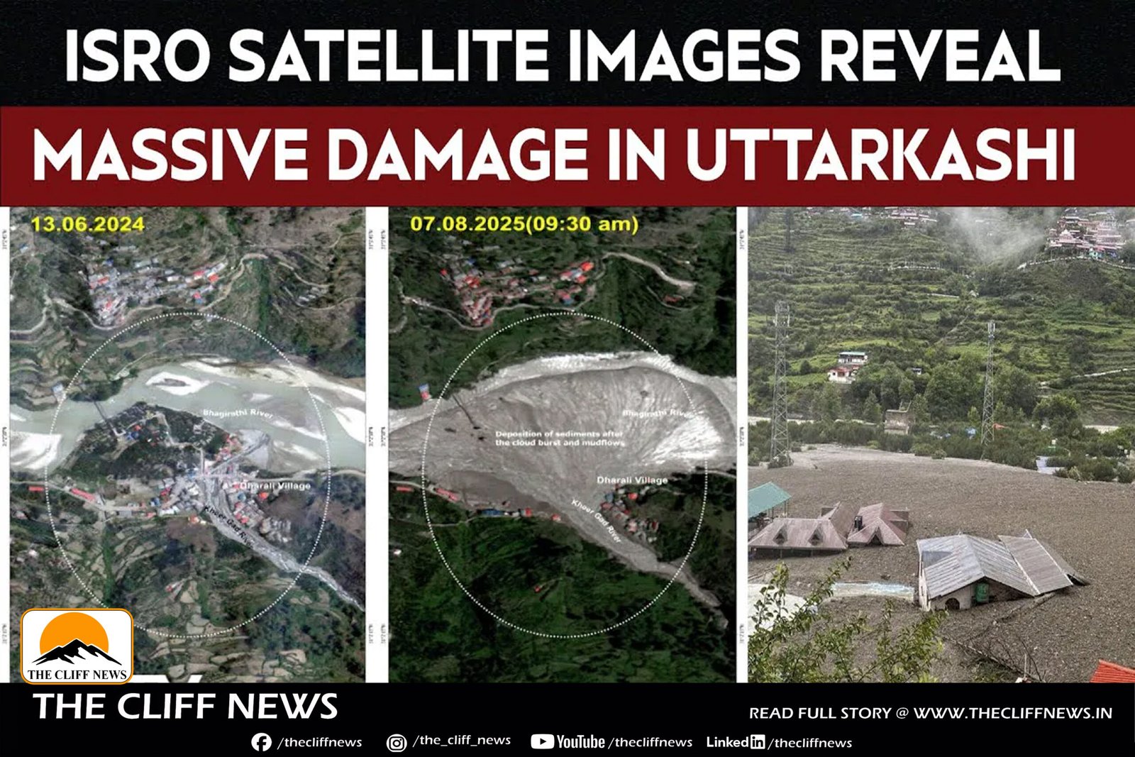
The before-and-after comparison makes it clear that this wasn’t just flooding; it was a sudden, high-energy flash flood that physically reshaped parts of the landscape. The widening of the Bhagirathi and Kheer Gad channels, plus the fan-shaped debris deposit at Dharali, are classic signs of a high-volume, short-duration flood surge.
The 20-hectare debris fan essentially tells the story: all that sediment, boulders, and mud had to come from somewhere upstream, likely mobilized by either a glacial collapse, a massive landslide into a river, or an extreme cloudburst event. Given Uttarkashi’s location in the fragile middle Himalayas, a combination of these factors is possible.
From a disaster-management perspective, these high-res images are gold — they let teams pinpoint vanished structures, trace blocked access routes, and plan temporary roads or air-drops. But they also underline a harder truth: Himalayan towns are increasingly exposed to fast-onset disasters driven by changing climate patterns and the region’s inherently unstable geology.